New online tool maps flood risk in Tampa Bay Area, Florida
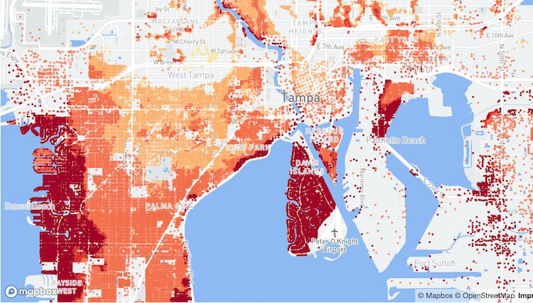
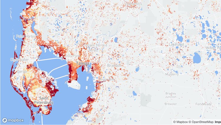
The nonprofit research and technology group First Street Foundation has publicly released flood risk data for more than 142 million homes and properties across the country, including Florida and the Tampa Bay region.
The nonprofit research and technology group First Street Foundation has publicly released flood risk data for more than 142 million homes and properties across the country, including Florida and the Tampa Bay region.
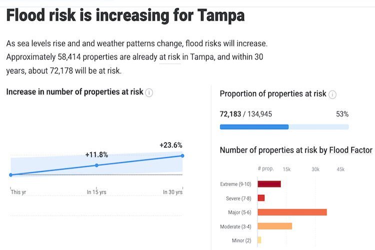
While FEMA classifies 8.7 million properties as having substantial risk, or within Special Flood Hazard Areas (SFHAs), the First Street Foundation Flood Model identifies nearly 70% more, or 14.6 million properties with the same level of risk, according to a news release from the Foundation.
Read the complete story.
Author

Related Articles

Partner Partner Content Choosing a Corporate Trustee: An Act of Compassion
Appointing a corporate trustee to manage your trust is a compassionate, forward-thinking decision.

Community Foundation Tampa Bay looks to build on record year for scholarships
In 2025, Community Foundation awarded more than 550 scholarships and over $2 million.

Public art projects embrace differences, build unity
Embracing Our Differences and the UNITED Mural Project use art to bring people together.